優惠套餐
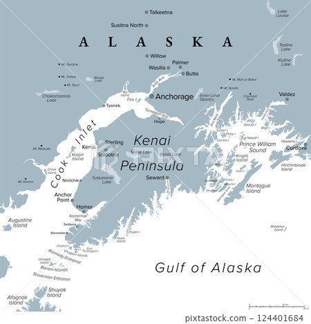
插圖素材: Anchorage and Kenai Peninsula, gray political map. Anchorage, most populous city of Alaska, and the Kenai Peninsula in the south, separated from mainland between Cook Inlet and Prince William Sound.
素材編號 : 124401684 查看全部
Anchorage and Kenai Peninsula, gray political...[124401684],此圖庫插圖素材具有阿拉斯加,地圖,向量的關鍵詞。此插圖素材是Peter Hermes Furian / (No.362672)的作品。您可以購買圖像大小從影像尺寸從S至XL, 向量圖US$5.00以上的尺寸。註冊成為免費會員後,您可以下載帶有浮水印的圖片以確認畫質及使用收藏夾的服務。 查看全部
Anchorage and Kenai Peninsula, gray political map. Anchorage, most populous city of Alaska, and the Kenai Peninsula in the south, separated from mainland between Cook Inlet and Prince William Sound.
縮放
* 您可以拖曳以移動圖片
版權 : Peter Hermes Furian / PIXTA
閱覽此素材的更多相關資訊
- 關於模特攝影使用授權和所有物權使用合同
- 查看數 : 57
- 過去的購買履歷 : 無
- 關於此素材的具體信息,請諮詢賣家。
