優惠套餐

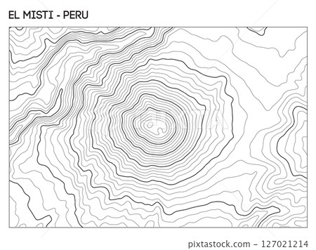
插圖素材: Topographic contour map of El Misti volcano in Peru showing central crater and symmetrical elevation contours. Contour lines vector terrain background.

素材編號 : 127021214 查看全部

Topographic contour map of El Misti volcano in...[127021214],此圖庫插圖素材具有地圖,背景,向量的關鍵詞。此插圖素材是DmitriyRazinkov / (No.1415228)的作品。您可以購買圖像大小從影像尺寸從S至XL, 向量圖US$5.00以上的尺寸。註冊成為免費會員後,您可以下載帶有浮水印的圖片以確認畫質及使用收藏夾的服務。 查看全部

Topographic contour map of El Misti volcano in Peru showing central crater and symmetrical elevation contours. Contour lines vector terrain background. 127021214

Topographic contour map of El Misti volcano in Peru showing central crater and symmetrical elevation contours. Contour lines vector terrain background.

  • 1:1
  • 4:3
  • 4:5
    (8:10)
  • 3:2(6:4)
  • 自訂
    :

縮放

* 您可以拖曳以移動圖片

S
  • 640 x 478px
  • 22.6 x 16.9cm (72dpi)
JPG US$5.00
M
  • 2000 x 1496px
  • 16.9 x 12.7cm (300dpi)
JPG US$15.00
L
  • 4000 x 2992px
  • 33.9 x 25.3cm (300dpi)
JPG US$30.00
XL
  • 5347 x 4000px
  • 45.3 x 33.9cm (300dpi)
JPG US$50.00
V 包括向量圖 EPS US$35.00
Ex 追加擴展許可證 +US$30.00
合計:
[免費]編輯素材

只要使用免費編輯工具,
就算尚未購買素材亦可嘗試圖片的編輯、加工
詳細內容請點確認

插圖素材: Topographic contour map of El Misti volcano in Peru showing central crater and symmetrical elevation contours. Contour lines vector terrain background.的關鍵詞

描述/評論
El Misti topographic map shows volcanic elevation and crater details. Contour lines highlight mountain structure near Arequipa in southern Peru. Geographic layers reveal terrain and symmetrical volcanic cone.